By Greg Anderson, President Wings Over The Rockies Museum
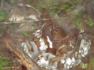
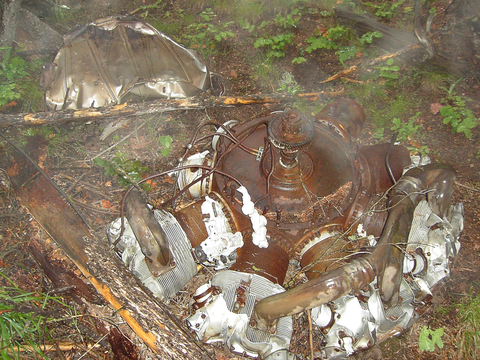
A powerful “Cyclone” engine rests on the mountainside. Four Cyclones took the B-17 on ten hour missions at high altitude deep into the enemy heartland.
Author’s Note: Having recently hosted the EAA B-17 Aluminum Overcast at Centennial Airport—allowing thousands of area residents to watch, tour and fly one of America’s most celebrated aircraft (see related story)—it is sobering to consider that another B-17 lies less than 15 miles away in the foothills west of Larkspur, Colo. Airport Journals’ request for my tale of discovering this wreck site reawakened a powerful sense of privilege and purpose in a museum’s mission to honor all whose heritage of flight has given much to our way of life.
On Saturday, Feb. 26, 1944, 10 young Americans stood on the aircraft parking ramp beside what is now Wings Over the Rockies Air and Space Museum. They looked into cloudy skies over Lowry Field and Denver and prepared to board their B-17 Flying Fortress for a routine combat training mission back to their home base in Clovis, N.M.
The crew came from 10 different states and the District of Columbia, representing a generation of Americans who would become known as the “greatest generation” because of their valiant service and sacrifice during World War II. No doubt they laughed and joked with one another the way young men do, looking forward to getting back to their base and, eventually, to the front lines overseas.
Unfortunately, they would not make it to either. On this day, shortly after departing Lowry, radio contact was lost. Nothing further was heard from the flight, and search efforts were unsuccessful. Finally, on May 22, 1945, a crash site was found on a remote hillside in the foothills southwest of Denver.
It is likely ice and winter weather brought the Flying Fortress and its crew to the earth. The aircraft broke up and burned. There were no survivors.
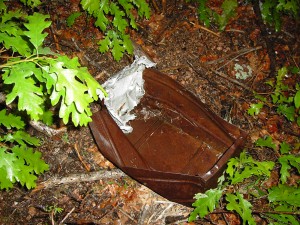
An ammo box lies beneath vegetation. Someone loaded this box, carrying it onto the aircraft for training with the gun positions that made the B-17 a “flying fortress.”
In 2004, I received a call from a reporter at the Rocky Mountain News who had heard about the wartime accident. Wings’ librarian Marilyn Chang provided research and information which had been previously reported by the Larkspur Historical Society and Douglas County Channel 8. My curiosity was piqued, and I decided to try to find the site.
I learned about a fascinating Web site which has a wealth of information on the Larkspur B-17 and dozens of others: [http://www.ColoradoWreckchasing.com].
The site is maintained by a number of people, providing crash site locations, histories and helpful search tips. Information is also available through a group of amateur aviation archeologists within the Colorado Aviation Historical Society. You can find them at [http://www.ColoradoAviationArcheology.org]. Both Web sites recommend responsible searching as well as training, meetings and sharing of information.
Consulting the wreck-chasing Web site, the Larkspur B-17 information is found through the “Military Sites” tab. Expedition accounts written by Ron Miller indicate that he made 12 separate search attempts to find the aircraft. Miller’s accounts were extremely helpful.
Even after reviewing these accounts (and using a handheld GPS), it took me two attempts to find the site. Private property east of the site requires access from the west via Rampart Range Road. A GPS is a requirement to find the site, and coordinates are available on the Web site.
The sawtooth ridge plainly visible to the southwest of Denver is named Devil’s Head, topped by a fire lookout station (which is another fascinating hike, but that’s another story). South of Devil’s Head on Rampart Range Road, a side road leads a couple miles to the east. Using my GPS, I got just over one mile from the site and parked my car.
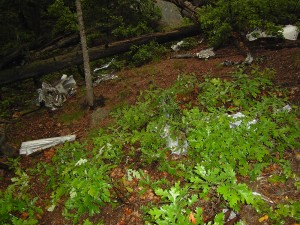
The debris field makes up a wide area where the B-17 came to earth, shearing trees, breaking up and burning.
I chose a weekend day in the fall for my second attempt. It was a cloudy day, and I was by myself—both serious mistakes in retrospect. The clouds turned to drizzle, making hiking treacherous. Being on my own was a mistake, because if I had turned an ankle or twisted a knee on the slippery hillsides, I would have been in deep “you-know-what.”
Having climbed 11 “fourteeners” (only three or four at that time), I consider myself a fairly good hiker. This two-mile round trip took me almost four hours. It follows an extremely steep, south-facing mountainside above winding streams. Vegetation is extremely dense and footing is loose. Large boulders and many fallen trees made 50 feet take several minutes at times. I slipped and fell at least 10 times, soaking myself on the wet ground. The cloudy skies and winding ravine made directional instincts difficult. Hence, the absolute requirement for a GPS and maybe even a back-up.
The difficult terrain obviously caused the long time span between the flight and discovery of the crash site. It has also discouraged visitors over the years, so when you come upon the site, you are greeted by a number of aircraft parts and all the strange sensations that come with them. The debris field is generally north to south down the hill, and trees were cleared as the airplane came to rest.
Engines, landing gear struts, crumpled parts and melted aluminum are scattered among scrub oak and pine trees. Much has been removed—ammunition, guns, the cockpit and human remains—no doubt by officials in 1945. Some visitors have placed small American flags in the debris, but for the most part, all seem to have respected the site.
It is difficult to look upon a place which obviously took apart a Flying Fortress and snuffed out the promising lives of 10 young servicemen. I looked at an empty ammo box in the weeds and wondered about the teenager who had loaded it, then at the 1,200-hp Cyclone engines that were serviced with tender loving care by other young men, now silent in their final resting place. I realized that this resting place was just a few miles north of the Air Force Academy, where I prepared to serve my country at the same age as those whose service ended here.
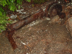
A rusting landing gear strut is seen here. Difficult terrain has limited the number of visitors to the site, and the few visitors have generally respected the remains.
A wind blew through the mist and trees and I shivered, not knowing if it was from the damp air or something else. Although this B-17 wasn’t brought down by enemy bullets, the crew’s sacrifice is no less real. Like walking through a cemetery, I suppose, one cannot help but think about the lives and deaths of brave young men who helped create the safe way of life we still enjoy today.
Ironically, you can look east from the site and see Larkspur. Had the B-17 been a half mile to the east, it may not have struck this high terrain. Since 2004, I have flown over the site many times in my airplane, once again with a GPS. If you look in just the right place, you can see shiny bits of aluminum glinting in the sunlight. On those days, reveling in the freedom of flight 65 years later, I am especially grateful that we still remember these men and others who worked and flew in the aluminum of thousands of B-17s.
Let it be said of us that we always will remember the brave crew:
Pilot: 2nd Lt. Joseph J. Beeson, Washington, D.C.
Co-pilot: 2nd Lt. Harry B. Davis, Philadelphia, Pa.
Navigator: 2nd Lt. Harry L. Barry, Columbus, Ohio
Flight Engineer: Capt. Fred Gentry, Decatur, Ill.
Bombardier: 2nd Lt. Jack T. Laird, Klamath Falls, Ore.
Gunner: Cpl. Ralph C. Judah,Iola, Kan.
Gunner: Cpl. James F. Perry, Charlotte, N.C.
Gunner: Joseph J. Fendrick, Queens, N.Y.
Gunner: Glenn L. Stutsman, Washington, Iowa
Gunner: James R. Young, Port Arthur, Texas
Sidebar Story: “Aluminum Overcast” Flies High Over Centennial Airport
